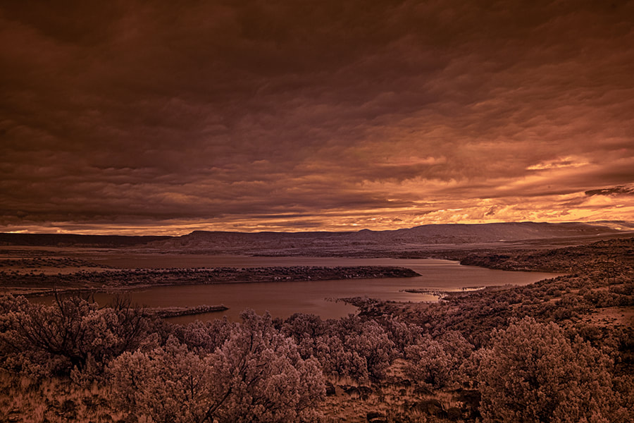
 Greg Lewandowski See Greg's Photography online The Ojitos trail can be found 8 miles down 151 off of 84. This is the monastery road. Be cautious on 151 there are very sharp switch backs and plenty of opportunity to slide off the road. Just at 8 miles on the left is a small parking are with some forestry boards up with info about the area. Skull bridge is also right there. On the right is the tailhead (TH). There is a pole marker near the TH. It’s a narrow trail and starts off uphill over rocky terrain. This is part of the Continental Divide Trail. It is well traveled and well maintained. There are no forks to worry about. Watch for switchbacks. As you hike up you will begin to see over your shoulder excellent views of the Chama River Valley, part of the Chama River Wilderness. I stopped frequently to take in these majestic views. The trail goes through a few clearings, some narrow uphill spots and always rocky. After about 2 miles you will go through a forested area. Quite lovely with the light through the trees as it hits the trail. After 4 miles you will have reached the top of the ridge where the trail flattens out. You will have climbed 1600 feet of elevation in 4 miles. On the top are more majestic views of the valley. I hiked another 2 miles before turning back. I found the top of the ridge to be a great spot for a backpacking trip. The morning and evening light on the red rock walls and the river would make for some great photos. I would rate this to be a moderately difficult hike. It took me about 7 hours and I covered close to 12 miles. Prep Hiking poles Sturdy hiking boots Although this is a day hike it is still a wilderness hike and I always carry appropriate equipment A search and rescue device, I use Garmin inReach. A GPS, I use the Gaia app on my iPhone. It will track me back if I get off the trail and I save the trail on my unit. I took 2L of water although I didn’t use it all I always pack a head lamp. Be safe and enjoy our wilderness area. 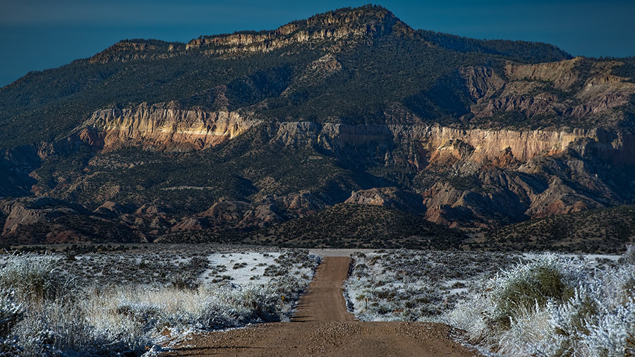 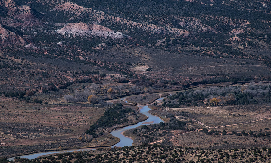 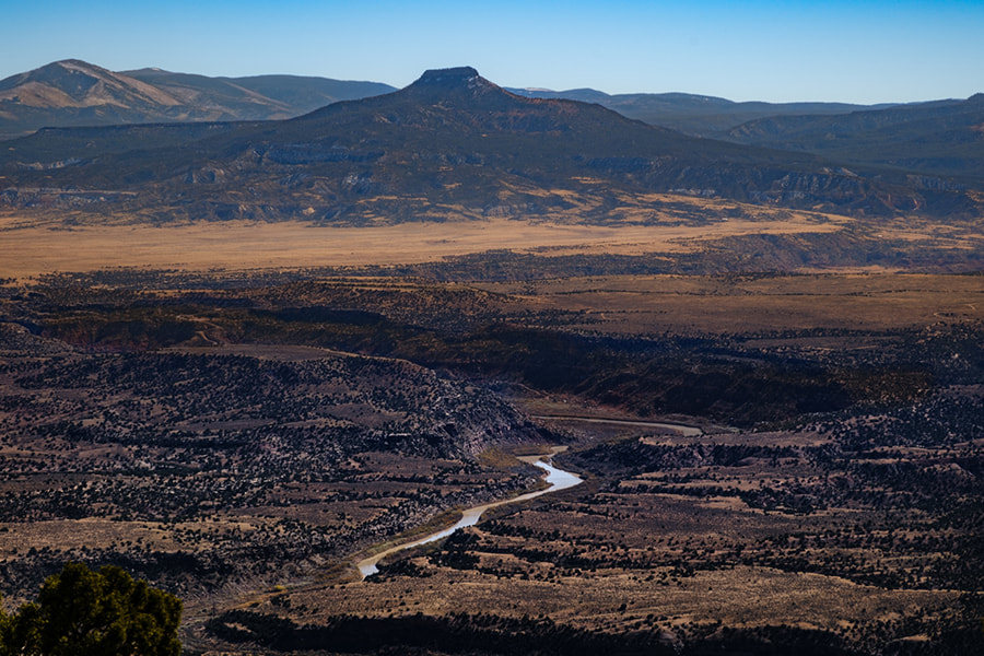  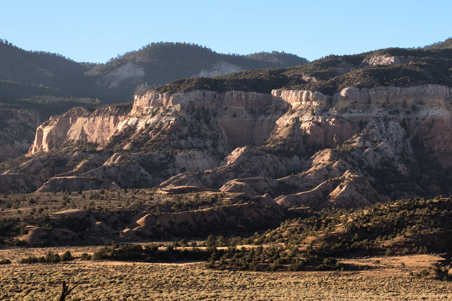 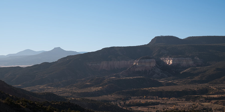
1 Comment
Rim Vista Trail
Length 5.8 mi Elevation gain 1,292 ft Route type Out & back The road to this trailhead can be rough- Users suggest having a high clearance vehicle. Moderately Challenging First you need to find FR 151. This is the road to the Monastery which is about 2.5 miles past Ghost Ranch. There will be a sign on your right for the Monastery and when you reach 151 turn left to head towards the Monastery. Approximately 1/2 mile down this dirt road is a sign on your right saying Trail. If you’ve gone a mile you missed it. Turn right onto a dirt road that leads to the trail head. The trail head is well marked and the trail is easy to spot. As you hike up you will gain 1300ft. of elevation. The hike is moderately strenuous and there are plenty of rocks to choose from. You will go approximately 2.3 miles to reach the top. Along the way you will see fantastic vistas of red rock, Abiquiu Lake and Pedernal. My favorite was the lake and the spectacular red rock. The vistas increase as you reach the top. Once there you can choose left or right paths. We chose the northern trail where I found the views spectacular and I was able to set my tripod on flat ground. Kevin and I enjoyed a leisurely hike stopping for photos and just to enjoy the scenery. And many thanks to Kevin Spitzer for showing me the trail head. We are planning more as the season progresses. For more info on the hike check out Abiquiu Inn for the book ’50 hikes in northern NM’. The Rim Vista train is number 21 on page 116. Happy Trails Greg Note: Always bring water and let someone know where you are going and expected return if hiking along. Once you get to the rim you might lose the trail back down so be careful to make note of the trail to return.
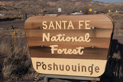
Images courtesy of Greg Lewandowski Poshuouinge
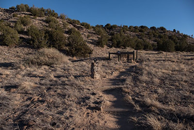
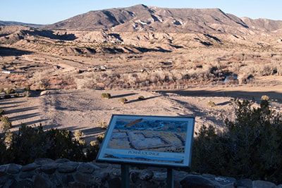
distance .5 mile, well marked Santa Fe National Forest Poshuouinge (pronounced "poe-shoo-wingay") is a large ancestral pueblo located on U.S. Route 84, about 2.6 miles south of Abiquiu. Its builders were the ancestors of the Tewa Pueblos who now reside in Santa Clara Pueblos and San Juan Pueblo. Poshuouinge was built on a high mesa, some 150 feet above the Chama River, around 1400. There are two springs located about 500 feet to the south of the ruins which are believed to have been the main water sources for the habitation. It is accessible by a United State Department of Agriculture Forest Service trail. Abiquiu and surrounding areas provide almost limitless year round hiking opportunities from beginner hikes to difficult one. One such hike is to the overlooks above Poshuouinge Ruins. This moderately steep, scenic half-mile ruin trail, has two vista areas and interpretive signs that overlook the Chama River Valley. There is no water. The trail rises approximately 220 feet from the parking lot to the hilltop overlook. The principal ruins included a large pueblo with over 700 ground-floor rooms surrounding two large plazas and a large kiva. Tree ring dates and the knowledge of local pottery designs indicate people lived at the site around AD1420 and abandoned it by the late 1400s. One tree ring date of 1391 suggest part of the village may have been built a generation or so earlier. If you want to explore a little further you can walk back on the mesa. 2.6 miles from the Abiquiú Post Office, south on Hwy 84. Approximately 18 miles south of Ghost Ranch. The trail is short but steep. Take only pictures and please stay on the trail. |
Submit your ideas for local feature articles
Profiles Gardening Recipes Observations Birding Essays Hiking AuthorsYou! Archives
July 2025
Categories
All
|


 RSS Feed